Bloggar
On attending the Geoforum summit 2023

My name is Aurélie, I’m a geographer specialised in geo-informatics. I’m a new team leader for the expertise of spatial planning at the faculty of bioeconomy and a new project leader at Novia UAS. The objective I need to reach is to develop awareness and competence about geographic information. Geographic information can tell you anything you want to know about any location you like; and that information is crucial to act efficiently every day.
In the last couple of months, I only started to identify uses and needs of geographic information within Novia and to assess the level of knowledge about it.
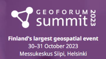
It was suitable for me to attend the 2023 Geoforum Summit organized in Helsinki these 30 and 31 October 2023 to also put myself to speed. The event gathers national actors in the geospatial industry technologies and displays seminars and workshops about the latest developments. It represented a great opportunity for me since I’m a foreign geoscientist now living and working in Finland (with my own network and spatial knowledge) and “GeoForum is a network that brings together players in the field of spatial information in Finland. The activity promotes cooperation between spatial information experts and organizations that use spatial data; between companies, public administration, educational and research institutions.” It was such an interesting event that I wanted to share my positive and negative notes, experienced with my own positionality.
First, the event was free of charge (only a pre-registration was needed), easily reachable from Pasila/Böle commuting station, without any stairs, with ungendered facilities, no paper program, showcasing open-source data platforms and map services. Then I got to visit booths related to consulting (Field, CGI), data management (Trimble, Spatial World) and processing (Terra Solid), map production (NLS), positioning devices and systems (Topcon, Geotrim, Kindhelm) and some geospatial platform (Vektor io, Helsinki Region Info share, Location Innovation Hub) and projects (Rythi). The presentations also displayed the latest information about projects (GeoVaPaa, ATMU) and technology (point cloud with 5P laser, digital twins) fitting perfectly under the three themes of the event: mapping and measurements, digital twins and factors of the future. Overall, checking almost all the principles of the open science framework.
 Riikka Kivekäs presenting new developments for the geodata portal hosted by National Land Survey of Finland. Credit: Aurelie Noel
However, I got disappointed for two reasons. The event itself was almost entirely in Finnish. Don’t get me wrong, I expected this before going as the entire website advertising the event was only in Finnish, but somehow, I had hoped otherwise once on-site. I also understand the event was not meant to be international hence the non-use of English, but I would be curious to know the opinion of all the non-Finnish speakers in the room, including Swedish speaking, the second official language. I found this unilinguist venue very restrictive and probably discouraged people who are important actors in the industry, whether they would have been presenters or attendees, although no versed in Finnish. My other pitfall is that there were only environmental and urban planning, -related presentations and booths. If we want to engage more people in the amazing and rich world of spatial data, we have to include those shadow-actors from unusual-er fields such as education, health and welfare, architecture, archaeology, social sciences such as citizen science, policies and regulations, etc. To only cite NLS projects, I would have loved to learn more about the CITYAM, a project about urban air mobility with drones and how to create smarter aerial space; or about Incubate and its use for indoor navigation system which would have potentially great applications in health care facilities or retailing shopping mall for personalized experience. There are applications in those sectors that exist and are not showcased. At that point the principles of equality of opportunities and inclusion seemed a bit flawed.
Overall, I got a lot of great outcomes. Of course, the challenge of networking was a bit higher than I thought but remained possible to a certain extent, and I got to look-up references and plenty of time to familiarize myself with existing open databases, comprehensive and educational platforms. It also gave some perspective to reflect on what we want to accomplish with the project I’m working on and the coming challenges. How to get more people involved and interested from outside of the existing geospatial bubble, including especially education since we’re training experts of tomorrow and they need a minimum knowledge of what is a geographic information and how it relates to what they’re doing, whatever the sector they belong to. Furthering that thought, the spatial competence centre we plan on establishing would definitely emphasize on those points.
Texten har granskats av Novias campusredaktion och publicerats 5.12.2023
![]()
Bioekonomi
Blogginlägg som är granskat av Novias redaktionsråd är utmärkta med nyckelordet "Granskat inlägg".
Vi följer CC-BY 4.0 om inget annat nämns.
Ansvarsfriskrivning: Författaren/författarna ansvarar för för fakta, möjlig utebliven information och innehållets korrekthet i bloggen. Texterna har genomgått en granskning, men de åsikter som uttrycks är författarens egna och återspeglar inte nödvändigtvis Yrkeshögskolan Novias ståndpunkter.
Disclaimer: The author(s) are responsible for the facts, any possible omissions, and the accuracy of the content in the blog.The texts have undergone a review, however, the opinions expressed are those of the author and do not necessarily reflect the views of Novia University of Applied Sciences.