
Novia pursues its literacy mission with the Spatial Competence Centre

Picture above: ESRI plenary session snapshot – August 2024
In a time of accelerated changes, “geography needs to be promoted for sustainability” (Fu, 2020) and resilience – we know it, now you will too.
INTRO
Raseborg experienced quite a drama in June 2025 when a groceries robot fell into Pojoviken while delivering its content. This is one example of how today’s landscape is dominated by spatial technologies such as location-based services, offering personal experiences on the spot when you want it where you want it.
Spatial data are now collected by anyone, from anywhere, in real time, shared to the world via social media and cloud services and used almost instantaneously by anybody else. This creates a plethora of opportunities such as virtual reality and the building of digital twins designing an entire space from the comfort of your chair, or automation of tasks with artificial intelligence deciding where and when to seed your oat field in the spring. But it also brings challenges linked to privacy and ethical guidelines, as we now can be anywhere and see everything through others that share anything, all the time - what can be trusted? In August 2025, Tim Walz, Governor for the State of Minnesota, USA mentioned during a plenary session about effective governance - “You (decision-makers) are creating change in a massive way” – “We have got to get the literacy on geographic and GIS out to the broader public so that we can make sure that that (effective governance) happens.” Spreading awareness of the power held by spatial data is our responsibility and it concerns all of us in order to be resilient partners in the not-so-far future.
SCC at Novia
In 2023, Novia identified the need for permanent spatial data literacy and awareness to achieve its goals of bringing transformative approaches within its community to build resilience. The Spatial Competence Centre (SCC) was then initiated as an internal project to fulfill this need. In 2024, the SCC has been officially launched and, as of this August, is now fully operational.
Whatever our background is, we all use spatial data to make the most informed, integrated, and strategic decision. Spatial data answer daily personal questions about where is this shop you need to go, or how long it takes to get to where you need to work. But spatial data are also at the heart of deeper decision-making in our professional life at Novia.
In research, spatial data serve a large range of users in bioeconomy (Red-throated divers project or NylAF project), business (CNE 2.0 project), technics (OFFwind project) or culture (Bothnia Business Heritage Network project) and a lot of potential is yet untapped.
Transdisciplinarity of SCC within Novia faculties
Spatial data are also already present in education programs in English and Swedish curricula. In masters’ program such as Natural Resource Management and Sustainable Coastal Management, there are Geographic Information Systems, GIS-project. In bachelor’ programs, such as Agrologist, Forestry and Land survey Engineering, there are GIS analysis, cartography and basics in GIS, GPS management GIS, management of natural resource data. Similarly to research, complementary spatial components could easily be inserted in education.
And additionally to students, other actors within Novia also use and learn about geospatial technologies daily, including staff.
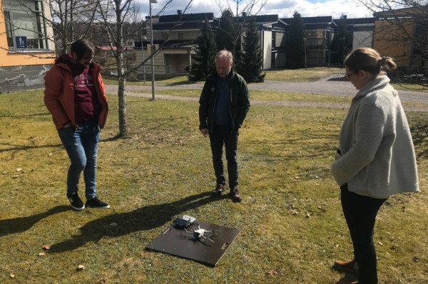
Drone workshop
The SCC has been designed as a transdisciplinary centre serving multiple purposes: mentoring, support and data broker, and allowing its perfect integration into Novia diverse portfolio.

SCC roles. The SCC is the middleman you didn’t even know you needed.
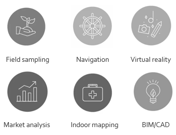
Hence the SCC could demonstrate how to store data, how to value them, how to map them, how to connect them, how to analyse them, or simply do all of that for you. The SCC works with a diverse set of tools under the umbrella of geomatics (i.e., geography and informatics) including GIS (geographic information system), cartography and mapping, photogrammetry, 3D visualization and design, R and modelling, GPS and fieldwork tracking, spatial analysis and networks, remote sensing imageries and drones. Finally, the SCC will also develop a platform to promote friendly access and storage for spatial data.
Its purpose is to serve as full interfaculty service unit.
More info
Have a look at our project webpage, its intro video, and its social network presence via its Facebook page or email us at scc@novia.fi. There is this auto-evaluation survey ready for you as well if you’re curious about spatial data:

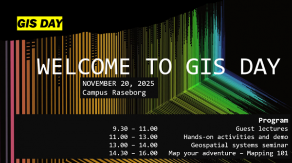
Come and visit us on campus Raseborg on November 20, it is GIS day and we will have our team seminar and also plenty of cool workshops and demos to participate (and badges to receive). The registration will open in the fall, but you can already save the day in your schedule!
The SCC is a member of the Geographical Society of Finland and the European Geosciences Union.
The blogpost has been reviewed by Novia's editorial board and accepted for publication on 10.9.2025.![]()